Seminário Medea-Chart

What is a Nautical Chart? Part II: The Treatises of Pedro Nunes about the nautical chart

Sala 8.1.67, FCUL, Lisboa
Imagem ilustrativa do evento

Por Joaquim Alves Gaspar (CIUHCT).

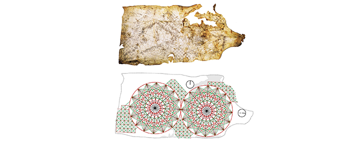
The pre-Mercator nautical chart is an amazing artefact of unexpected complexity. Not because its construction relied on sophisticated methods but, on the contrary, owing to the limitations imposed by contemporary navigation, which prevented the adoption of the cartographic paradigms prescribed by Ptolemy on his Geography - that is - the use of latitudes and longitudes in chart making. Those limitations were the impossibility of determining longitude on board and the errors caused by the uncorrected magnetic declination on the directions measured with the marine compass and transferred to the charts. In this talk, the geometry of the medieval and early modern nautical chart is described. The concepts of internal and external geometry of the charts are introduced, which help to better identify the distortions affecting them and how the contemporary navigators dealt with the problem.

10h30
CIUHCT - Centro Interuniversitário de História das Ciências e da Tecnologia
CIUHCT
Saída de campo (Geologia)

O curso, com candidaturas até 20 de julho, convida os professores do Ensino Básico e Secundário a explorar a Geologia a partir das rochas que afloram nas imediações da sua escola.

Gotas de água

O curso visa capacitar os formandos para a aplicação dos índices de qualidade ecológica utilizados na avaliação da qualidade ambiental em sistemas de transição, no âmbito da Diretiva Quadro da Água (DQA) - candidaturas até 31 de agosto.

The conference aims to bring together key experts in the Medical Microwave Imaging (MMWI) field and will include invited talks, presentations and posters of peer-reviewed abstracts and conference papers, and workshops in satellite areas of research that are of interest to MMWI research.

Páginas